myTracks
As much as possible, I like to leave the car at home when I venture outside for some adventure. That might mean biking to a trailhead to do a trail run. Or busing to the local mountain for an early morning skin. Or biking/running/hiking to the local boulders for a lunch time bouldering session. It's fun to think up new ways to join activities into a unique adventure. (By the way, Alex and Cedar had it right in Sufferfest.) myTracks is what I built to record and share these multi-sport outings.
The idea to record these trips came years ago, but now with new tools and new knowledge, I can do it right, or at least righter.
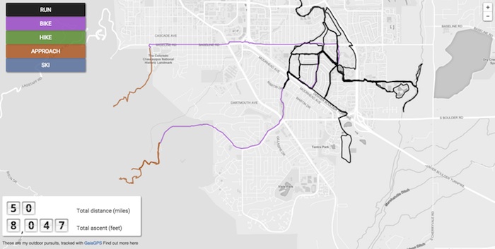
The execution was fairly simple. I put together a web map using Leaflet for the basic functionality and Mapbox for the base map tiles. I track my motion using GaiaGPS on my phone and label each track with "run", "bike", etc. depending on the activity. GaiaGPS makes it easy to download the tracking data in various formats, so I download it all as a GeoJSON file, convert it to TopoJSON to minimize the file size and load it into the map with a little Javascript code.
Thoughts & Observations
- It's pretty obvious where I live.
- Maybe someday GaiaGPS will have an API that will allow dynamic loading of data. Right now it's a manual process.
- It would be awesome to see this data for ALL GaiaGPS users. It could be the outdoor equivalent of the Strava heat map!